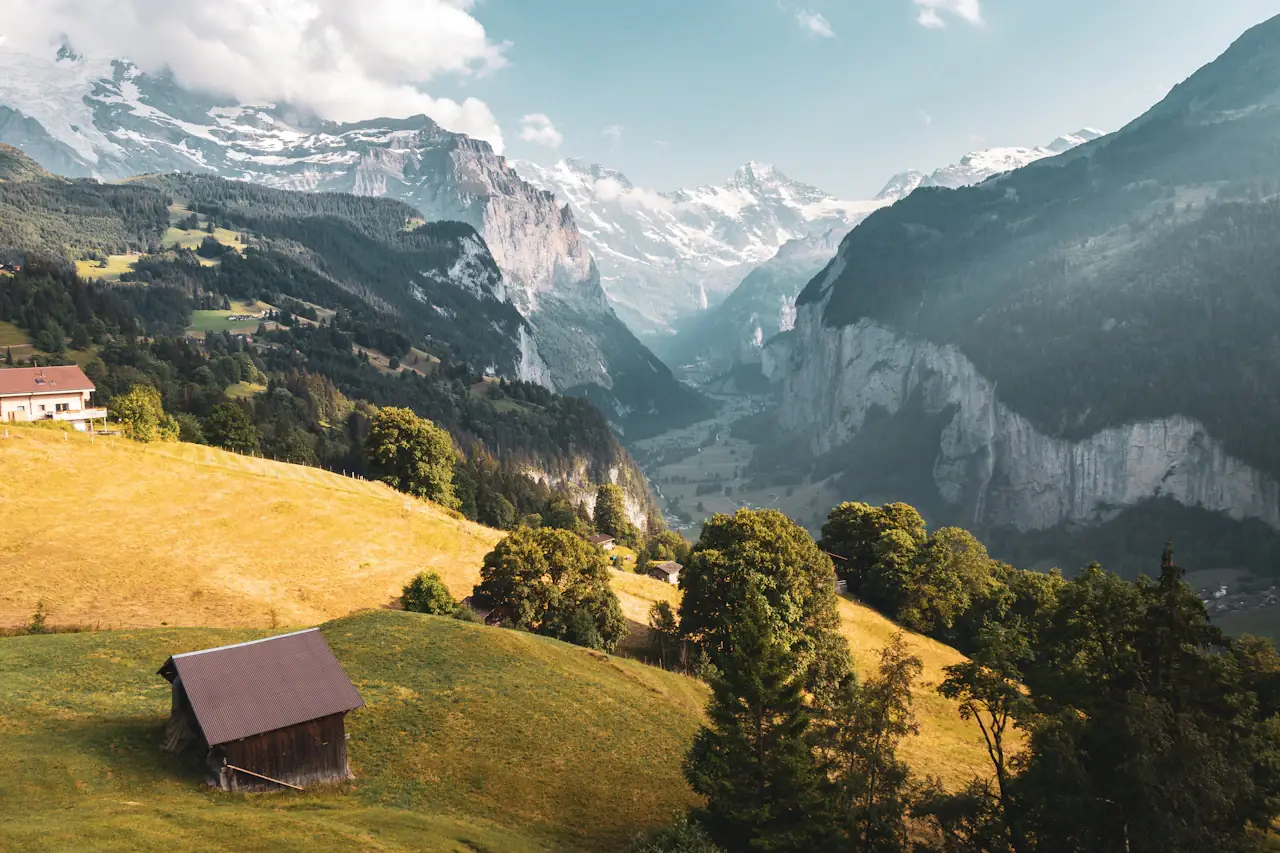
Pick Zermatt if you want a car-free base and the Matterhorn in view, with a mountain railway to get you up. Pick the Jungfrau Region if you want several villages and a choice of rail-served hikes under the Eiger, Mönch and Jungfrau. Grindelwald and Lauterbrunnen are two bases in that same region, in neighbouring valleys, so you can stay in one and walk from both. No official page ranks the three places, so the choice comes down to what you want to walk, how you arrive and which tickets you buy.
The three places at a glance
| Zermatt | Grindelwald | Lauterbrunnen | |
|---|---|---|---|
| Car-free? | Yes. Private vehicles stop at Täsch | No. Public car parks in the village | No, but Wengen and Mürren above it are car-free |
| Official trail count | 73 hiking trails listed by the tourist board, each with a difficulty label and time | Routes, themed trails, walks and long-distance hikes listed on its hiking page | Walking trails from leisurely strolls to mountain hikes on its hiking page |
| Rail or lift access | Gornergrat Railway; mountain railways to Sunnegga and Blauherd | First cable car; Männlichen cable car; trains to Eigergletscher for the Eiger Trail | Lauterbrunnen-Mürren rail and cableway; Wengernalp railway; trains up to Kleine Scheidegg |
| Typical walks | Matterhorn lakes, short railway-top loops, a two-day Europaweg | Bachalpsee, Eiger Trail, Männlichen high-altitude trails | Flat valley walk past waterfalls, Oberhornsee, Mürren trails |
Hikes in Zermatt
The Zermatt hiking trail list lists 73 hiking trails. The trail list gives each one a difficulty label and a time. The labels below are the site's own.
| Hike | Label | Time | Distance |
|---|---|---|---|
| 360° Loop Gornergrat (No. 91) | Easy T1 | 20 min | 0.5 km |
| AHV path / Lower High Path (No. 33) | Easy T1 | 1 h | 2.2 km |
| Furiweg (No. 51) | Easy T1 | 55 min | not listed |
| Suspension Bridge Trail Furi (No. 50) | Moderate T2 | 1 h | not listed |
| 5-lake route (No. 11) | Moderate T2 | 3 h 30 min | 11.3 km |
| Glacier trekking to Monte Rosa Hut (No. 37) | Demanding T4 | 3 h 30 min | not listed |
| Europaweg, Grächen to Zermatt | Demanding T3 | 13 h 30 min in total | 39 km |
5-lake route. The official page gives 11.3 km, 265 m of ascent and 542 m of descent, between a lowest point of 2,130 m and a highest of 2,617 m. You start at Blauherd (2,571 m) and finish at Sunnegga (2,288 m), passing Stellisee, Grindjisee, Grünsee, Moosjisee and Leisee. The Matterhorn is reflected in three of them (Stellisee, Grindjisee and Leisee). The page calls the route suitable for children from 6 and mentions swimming at Leisee and Grünsee. It also warns that even when the trail status shows open, the mountain railways may be only partly running or running only up to Sunnegga, so check the railway timetable before each hike.
Gornergrat. The Gornergrat Railway takes 33 minutes from Zermatt and climbs more than 1,500 m to about 3,100 m above sea level. You can get off at Findelbach, Riffelalp, Riffelberg and Rotenboden. The valley station is opposite Zermatt railway station. The short 360° Loop at the top is labelled Easy T1.
Europaweg. It is a two-stage walk from Grächen to Zermatt: Grächen to the Europahütte takes 6.5 to 7.5 hours, and the Europahütte to Zermatt takes 6 to 7 hours. The total is 2,550 m of ascent and 1,882 m of descent. On the way you cross the 494 m Charles Kuonen suspension bridge, which the page describes as the longest pedestrian suspension bridge in the Alps. The Europaweg page carries closure and detour notices for some sections, so read the current notice on zermatt.swiss before you plan it.
Multi-day tours. The hiking page also lists Tour Monte Rosa - Matterhorn, Monte Rosa Trek, Tour Matterhorn, High path and Matterhorn Trek.
Safety rules from the page. Do not leave marked paths. Do not go on glaciers without a mountain guide. Turn back in time if the weather is uncertain. Carry rain protection.
Hikes in the Jungfrau Region: Grindelwald and Lauterbrunnen
From Grindelwald
| Hike | Time and height | Who it suits, per the official pages |
|---|---|---|
| First to Bachalpsee | Under an hour to the lake, about 2 hours return; lake at 2,265 m (jungfrau.ch) | Listed among the easy walks; starts and ends at the First mountain station |
| Eiger Trail | 6.1 km; about 2 hours from Eigergletscher down to Alpiglen, 2.5 hours the other way; 2,348 m down to 1,616 m (jungfrau.ch) | Its own page rates it "Moderate"; the hiking overview groups it with hikes for experienced hikers: "steep climbs, long distances", good fitness and surefootedness |
| Schynige Platte to First | 16 km; about 6 hours in either direction; highest point 2,681 m on the overview, 2,672 m on the hike's own page (jungfrau.ch) | Rated "Moderate" on its own page and also in the experienced-hiker group; via Loucherhorn, Faulhorn and Bachalpsee |
First to Bachalpsee. The First mountain station is at 2,168 m, according to grindelwald.swiss, which puts the walk to the lake at about one hour. jungfrau.ch says "in less than an hour" and gives about 2 hours for the return trip. Neither page gives a distance in kilometres.
Eiger Trail. It runs from Eigergletscher station down to Alpiglen along the foot of the Eiger north face. You can walk it in either direction, and the train ride is included in the ticket.
Schynige Platte to First. This can also be walked either way, and the return train journey is included in the ticket.
Männlichen. Grindelwald's tourist board says you reach Männlichen by the Grindelwald-Männlichen cable car from Grindelwald or the Wengen-Männlichen cable car from Wengen. High-altitude trails lead to Alpiglen and Kleine Scheidegg. The Royal Walk is a short hike to the summit (2,342 m). Families can use the Lieselotte and Öpfelchüechli themed trails.
Long-distance options. Stages 15 and 16 of the Via Berna are in Grindelwald, the Via Alpina passes through the village, and SAC huts allow hut-to-hut tours.
From Lauterbrunnen
- Valley walk. The Lauterbrunnen tourism pages describe a mostly flat walk from Lauterbrunnen to Stechelberg, past streams falling down vertical rock faces.
- Oberhornsee. A walk from Stechelberg up to a mountain lake in the Jungfrau-Aletsch UNESCO World Heritage Site, with views of the steep, in places icy, north faces of the Grosshorn and Mittaghorn.
- Detective Trail, Grütschalp to Mürren. About 2.5 hours, 1,656 m to 1,492 m. jungfrau.ch aims it at families, with riddles to solve on the way.
- Mountain View Trail to Allmendhubel. About 2 hours. jungfrau.ch lists it in the experienced-hiker group, above the Lauterbrunnen Valley.
- Staubbach Falls. A drop of about 297 m, which Lauterbrunnen tourism calls the highest free-falling waterfall in Switzerland. It is strongest in spring and early summer, and the path to its base is open only in summer.
- Trümmelbach Falls. Part of the valley's 72 waterfalls, and open daily from the beginning of April to the beginning of November. Children under 4 and dogs are not allowed in for safety reasons. The exact opening and closing dates depend on the weather (Lauterbrunnen tourism).
For children, jungfrau.ch also lists Lily's Puzzle Trail (ages 4 to 11, about 45 minutes).
Getting there from Zurich or Geneva
| From | Zermatt | Grindelwald |
|---|---|---|
| Zurich Airport | 3.5 hours | About 3 hours |
| Geneva Airport | 4 hours | About 4 hours, change in Bern |
| Basel Airport | 4 hours | About 3 hours |
Zermatt's arrival page says trains run to Zermatt every half hour. Rail connections are in the SBB timetable or the Matterhorn Gotthard Bahn timetable.
For Grindelwald, grindelwald.swiss says direct trains run every two hours from Zurich Airport to Interlaken Ost, with more connections via Bern. From Interlaken Ost the Berner Oberland Bahn (BOB) runs to Grindelwald without a change, in about 30 minutes. jungfrauregion.swiss says 29 minutes to Grindelwald Terminal and five more to the village terminus.
For Lauterbrunnen, the official pages give no total from Zurich or Geneva. They do say the BOB from Interlaken Ost takes 20 minutes. Wengen is 37 minutes and Mürren 53 minutes from Interlaken Ost, both via Lauterbrunnen.
Watch the split at Zweilütschinen. The BOB train divides there. Board the rear section for Grindelwald and the front section for Lauterbrunnen, or you end up in the wrong valley.
Both regions can send luggage ahead. SBB's luggage service works for Zermatt, and the Jungfrau Region's site describes the SBB Luggage Special from the airport or station to your hotel.
Is Zermatt really car-free?
Yes. According to zermatt.swiss, private vehicles are only allowed as far as Täsch, five kilometres before Zermatt. From Täsch you take the train, a taxi or a limousine service. The shuttle train takes 12 minutes and runs every 20 minutes. The Matterhorn Terminal in Täsch has 2,100 covered parking spaces, and private providers offer more than 1,000 more.
The page says the same rules apply to electric vehicles as to conventional cars, so an electric car cannot drive to Zermatt either. It also warns that you can expect to pay large fines if you travel to Zermatt without authorisation.
Inside the village you get around by e-taxi, horse-drawn carriage, bicycle, on foot, or on the free e-bus, which has two routes.
Grindelwald and Lauterbrunnen are not car-free. The Jungfrau Region's site lists three public car parks in Grindelwald: Eiger+ (252 spaces), Sportzentrum (160 spaces) and the V-cableway terminal (1,000 spaces), plus another at Grindelwald Grund. In Lauterbrunnen there is a multi-storey car park directly below the railway station, and another by the church. Wengen and Mürren are car-free: leave the car in Lauterbrunnen, or in Stechelberg for Mürren. The same page also recommends a trip by SBB and the local mountain railways without a car, and warns that roads may be snow-covered in winter.
Which pass do you need?
Think about the shape of your trip, not about a single price.
| Pass | What the official pages say |
|---|---|
| Swiss Travel Pass (SBB) | Unlimited travel by train, bus and boat, by panorama train (excluding seat reservations and supplements), and on the Rigi, Stanserhorn and Stoos mountains; local transport in over 90 towns and cities. 3, 4, 6, 8 or 15 consecutive days, or the Flex version with 3, 4, 6, 8 or 15 freely chosen days within one month. For people whose permanent residence is outside Switzerland and Liechtenstein |
| Half Fare Card (grindelwald.swiss) | Half price across the Swiss network, including the mountain railways in Grindelwald; valid 30 days for people living outside Switzerland and Liechtenstein |
| Jungfrau Travel Pass (jungfrau.ch) | 3 to 8 days of unlimited travel on trains, buses, boats and mountain railways in the Jungfrau Region, with a special fare for the Jungfraujoch |
| Grindelwald Guest Card | Given to overnight guests in Grindelwald; discounts on the Pfingstegg, Männlichen and First cable cars, and free local bus |
Swiss Travel Pass details. Children from 6 to under 16 travel free with a parent if you add them with the Swiss Family Card; under 6 travel free. Show the original passport or ID at inspection, since copies and phone photos are not valid. You can buy it up to 11 months in advance. SBB says the pass gives a 50% discount on other mountain excursions and leisure offers from RailAway, and that the Flex discount is valid only on activated travel days. grindelwald.swiss says the pass gives "a discount" on mountain-railway tickets, without a percentage. Check the operator's ticket page for the exact reduction on the day for First, Männlichen or the Gornergrat. Zermatt's page confirms that people who live outside Switzerland and Liechtenstein are eligible for the pass, but it does not say what the pass gives on the Gornergrat Railway.
Jungfrau Travel Pass details. Highlights included are Grindelwald-First, Schynige Platte, Harder Kulm, the Lauterbrunnen-Mürren rail and cableway, and Lauterbrunnen, Wengen and Kleine Scheidegg. grindelwald.swiss adds that it does not include Pfingstegg. It also lists the Berner Oberland Pass, which covers more than 25 mountain railways.
Which should you choose?
- First trip, mainly Matterhorn views, and you like a car-free village: Zermatt. The Gornergrat Railway and the 5-lake route are the official pages' main hooks.
- Family with children: both work. In Zermatt, the 5-lake route is listed as suitable from age 6, with a playground and picnic facilities at Leisee. In the Jungfrau Region, the Detective Trail, Lily's Puzzle Trail and the Männlichen themed trails are aimed at children.
- You want a choice of rail-served hikes from one base: Grindelwald or Lauterbrunnen. Both sit on the BOB line from Interlaken Ost, and you can walk from both.
- A harder day out: In the Jungfrau Region, jungfrau.ch groups the Eiger Trail, the Mountain View Trail and Schynige Platte to First as hikes for experienced walkers. In Zermatt, the Europaweg is labelled Demanding T3 and the Monte Rosa Hut glacier trek Demanding T4.
- Waterfalls and valley walks: Lauterbrunnen.
- Mostly one base with a few cable-car days: look at individual hiking tickets for your chosen walks, alongside the Jungfrau Travel Pass for 3 to 8 days of travel in the region.
- Moving between regions by train: the Swiss Travel Pass covers the national network, and the Half Fare Card halves the fare across it, including Grindelwald's mountain railways.
- Arriving by car: Zermatt means parking in Täsch. Grindelwald and Lauterbrunnen have car parks, but Wengen and Mürren do not allow cars.
When can you hike, and is it open?
The Zermatt hiking page says trails open in spring, and that hiking is possible in summer and autumn, with prepared winter trails in winter. The official pages do not give month dates for Zermatt's high trails or a single hiking season for the Jungfrau Region.
The Gornergrat Railway timetable for 20 April to 1 November 2026 shows a train every 24 minutes from 08:00, with the first train from Zermatt at 07:00. Service is suspended from 2 to 14 November 2026 for construction work. The Trümmelbach Falls are open daily from the beginning of April to the beginning of November, with exact dates depending on the weather.
Before you set out, use the tourist boards' status pages: "Hiking trail status" on grindelwald.swiss, "Status of facilities & Walking trails" on lauterbrunnen.swiss, and the panorama map and lift timetable on zermatt.swiss. jungfrau.ch says trail conditions are recommendations only and that walking is at your own risk.
Need flights or a hotel quote?
If you want help with flights or a hotel for your Swiss trip, contact us with your travel dates and we will send a quote.