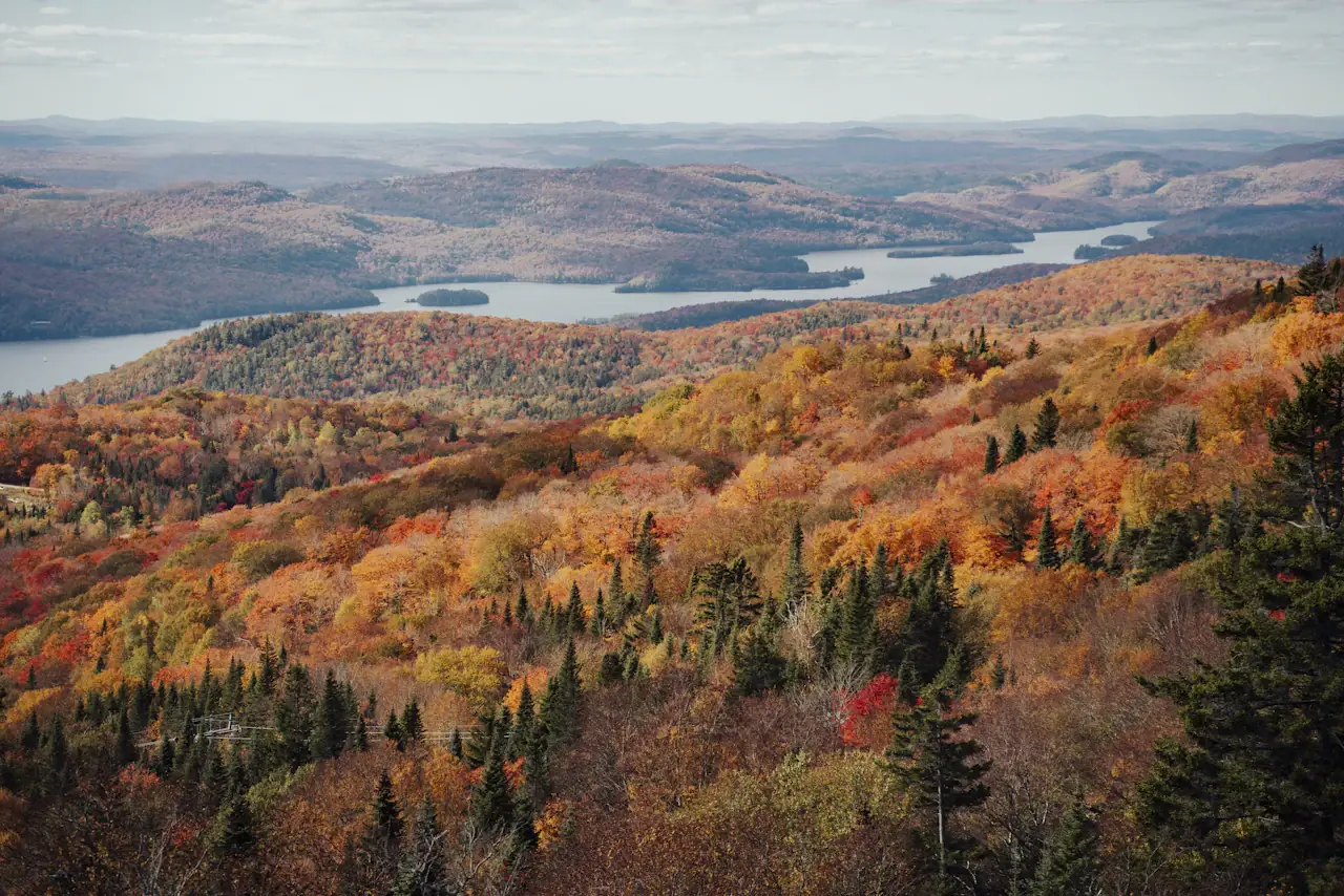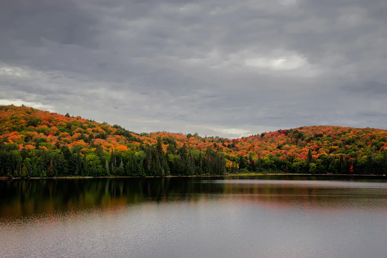
Colour peaks at different times depending on where you go, and nobody can promise a date. Algonquin Park's Sugar Maples peak on average around September 27; a second, golden peak takes hold once most maple leaves have fallen, and the exact timing differs from year to year. Muskoka's tourism board estimates October 4–8 for maple peak around Huntsville and October 9–18 for the golden stage. Toronto itself changes later than Algonquin, and the official pages give no Toronto dates. Read the numbers below as historical patterns and Muskoka's estimates for this year, not guaranteed dates.
When do the colours peak in 2026?
| Area | What the official pages say |
|---|---|
| Algonquin (Highway 60 corridor) | Average Sugar Maple peak September 27 (observations since 1973). Earliest recorded September 15 (1982), latest October 9 (1996). 2024 peak: October 4. 2025 peak: September 25. Best viewing: mid-September to mid-October. |
| Algonquin, second peak | The "golden encore" usually starts about a week after the maple peak and can last through much of October, sometimes into early November. Tamarack is at its best yellow in mid to late October. |
| Muskoka (Huntsville guide) | Early colour September 20–October 3. Peak maple October 4–8. Peak golden encore October 9–18. Muskoka Tourism calls this a best guess from historical data. |
| Killbear Provincial Park | Ontario Parks says colours usually peak around Thanksgiving weekend. |
| Toronto | Not stated. Algonquin sits up to almost 600 metres above sea level and Toronto at 75 metres, so Algonquin's best colour can come several weeks or more earlier. |
The park's own page says the exact peak is hard to predict, because daylight, moisture, temperature, frost, wind and heavy rain all matter. Wind or rain can knock fragile leaves off quickly. The last two years show the spread: 2024 peaked a week after average after a warm stretch in mid-September, and 2025 peaked slightly early, which the Friends of Algonquin Park link partly to drought stress.
The colours also come in stages. Maples give the orange and red hillsides. After that, beeches turn golden-yellow, birches and poplars glow yellow, some Red Oaks go brownish-red to scarlet, and tamaracks (the one conifer that turns) go deep gold. If you arrive after the maples, you have not missed the season.
Canadian Thanksgiving weekend in 2026 is October 9–12. Expect Algonquin to be especially busy then.
How can you track the colour change?
- Ontario Parks Fall Colour report. The tracker lists each park with a report date, dominant colour, a "Colour Change" figure, a "Leaf Fall" figure and where to look. Report dates differ by park (for example, Algonquin is dated September 25 and French River September 14), so check the date on the entry you use.
- Friends of Algonquin Park. Their Fall Colour Report page has a status diagram by tree species. The copy used for this guide still showed the 2025 season as concluded and said the 2026 report would start in early to mid-September 2026, so use the Ontario Parks entry for current Algonquin numbers. The Friends also run an Algonquin webcam for live views.
- Discover Muskoka. It keeps its own Fall Colour Report and posts the date estimates in the table above.
- Capacity and roads. Algonquin posts capacity updates on social media. Before you drive, check Ontario's 511 Travel Information Service for congestion and accidents on provincial highways.
Ontario Parks' Fall Colour page has a map as well as the tracker table: each park's leaf icon shows its current colour change and leaf fall, and icons outlined in red mark parks approaching or at peak viewing. The Friends of Algonquin Park page has a species diagram. Algonquin's Autumn Day Use Guide does include a map of Highway 60.
Where should you go for fall colours?
Algonquin Provincial Park
It is Ontario's best-known fall destination, and Ontario Parks itself says it is very busy in fall and suggests considering other parks. The September 25 report shows dominant colour yellow/orange, Colour Change 80 and Leaf Fall 10. Stay on the Highway 60 corridor, where most facilities are.
- Lookout Trail. If its parking lot is full, a 450 m connector trail links the Big Pines Trail lot to the Lookout Trail lot. Do not walk along the highway.
- Hardwood Lookout Trail. Closed on five weekends, including Fridays and holiday Mondays. The two still ahead are October 2–4 and October 9–12.
- Booth's Rock Trail. Needs a special permit from September 12 to October 18 (see the permit section).
- Fork Lake Trail. New, 2.4 km at the Visitor Centre, rated difficult.
- Tamaracks. Look in wetlands and bogs: the Spruce Bog Boardwalk, the Mizzy Lake Trail and Opeongo Road.
- Cycling. The Old Railway Bike Trail is 16 km and flat; bikes can be rented at the Two Rivers Store.
- Visitor Centre. Open daily 9:00 a.m. to 5:00 p.m. It does not sell permits.
- Oxtongue River–Ragged Falls. The tracker shows orange, Colour Change 50, Leaf Fall 10 (September 25). The short trail to the top of the falls has the best view.
Ontario Parks suggests a route for people coming from the Greater Toronto Area: enter through the East Gate. Take Highway 35/115 north to Peterborough, Highway 28 north to Bancroft, Highways 62 and 127 north to Whitney, then Highway 60 west; the gate is about 5 minutes from Whitney. The park says this route usually has less congestion than the West Gate, where most visitors arrive from Huntsville.
Muskoka
Muskoka is lakes, small towns and lookouts, and it works well for a weekend. From the official pages:
- Gravenhurst. Peninsula Trail, just under one kilometre, with views of Lake Muskoka.
- Bracebridge. High Falls, Wilson's Falls and Bracebridge Falls are all within five minutes of downtown. Huckleberry Rock Lookout Trail is the hike for panoramic views.
- Huntsville. Lions Lookout Trail is a short uphill hike with views of Fairy Lake and town. Arrowhead Provincial Park is in the quieter-parks table below; Ontario Parks does not state its permit or fee in the pages used here.
- Dorset Scenic Tower. 142 metres above Lake of Bays, about a 30-minute drive east of Huntsville, open May through October. Tickets must be bought in advance and parking fees apply; amounts are not stated.
- Cruises. Muskoka Steamships (Gravenhurst), Muskoka Cruises and Sunset Cruises (Port Carling) and Island Queen (Parry Sound) run fall cruises. SS Bigwin is closed for 2026.
- Driving loops. Muskoka Tourism lists circle tours. "Past & Future" is a 100 km loop from Huntsville. "Muskoka's Heart" is 245 km and takes roughly 4–6 hours. "Gateway to Muskoka & Beyond" circles Lake Muskoka from Gravenhurst through Bala, Port Carling and Bracebridge. Its page carries a 2025 copyright.
- Cranberry harvest. September 26–October 25, 2026, at Muskoka Lakes Farm and Winery.
Niagara
Niagara is the pick if you want wine, waterfalls and towns more than long hikes. Destination Ontario's fall itinerary runs from Niagara Falls to Toronto over 4 days, with a backdrop of fall colours. Its stops:
- Niagara Falls. Horseshoe Falls, the Whirlpool Aero Car over the Niagara River, and Niagara Parks' Botanical Gardens with the Butterfly Conservatory on the Niagara River Parkway.
- Niagara-on-the-Lake. 25 km and 25 minutes from Niagara Falls. Historic Heritage District, Fort George National Historic Site, wineries, and the Niagara River Parkway, which many consider Ontario's prettiest drive.
- St. Catharines. 20 km and 30 minutes from Niagara-on-the-Lake. Decew Falls trails and the Welland Canals viewing platform at Lock 3.
- Niagara Benchlands. 15 km and 15 minutes from St. Catharines. Balls Falls Conservation Area has a one-mile trail along a creek to cascades and waterfalls, part of the Bruce Trail.
The official pages give no peak dates for Niagara and no drive time from Toronto. The Ontario Parks blog says parks in Ontario's southwest are places to see colour later in the season; Pinery and Port Burwell both posted Colour Change 0 on September 24.
Quieter alternatives
Ontario Parks points Algonquin visitors to Driftwood and Arrowhead, Mono Cliffs visitors to Earl Rowe, and anyone willing to go farther north to Restoule and Mikisew. The official text gives no drive times from Toronto for any of these, so check a map. Latest tracker entries:
| Park | Report date | Dominant colour | Colour Change / Leaf Fall | Note |
|---|---|---|---|---|
| Arrowhead | Sept 25 | Orange | 50 / 10 | Big Bend Lookout, Beach Area #1 |
| Lake St. Peter | Sept 25 | Orange | 30 / 10 | Lookout Trail, 2.5 km, strenuous |
| Mikisew | Sept 25 | Green | 30 / 10 | Beaver Meadow and Maple Canyon trails |
| Earl Rowe | Sept 25 | Green | 20 / 10 | Lookout Trail, campground walks |
| Mono Cliffs | Sept 25 | Green | 20 / 10 | Reservations required to guarantee access |
| Forks of the Credit | Sept 25 | Green | 20 / 10 | Reservations required to guarantee access |
| Killbear | Sept 25 | Green | 20 / 0 | Usually peaks around Thanksgiving weekend |
| Sibbald Point | Sept 24 | Green | 20 / 20 | Advance daily vehicle permit |
| Balsam Lake | Sept 24 | Green | 10 / 10 | Sumac on the Lookout Trail should turn red soon |
| Restoule | Sept 21 | Green | 10 / 0 | Fire Tower Trail, River Trail |
| Driftwood | Sept 21 | Green | 10 / 0 | Oak Highlands Trail, canoe rentals |
Rental canoes: Ontario Parks warns that rental facilities at many parks close after Labour Day, so confirm before you plan a paddle.
How long is the drive, and do you need a car?
| Destination | From Toronto (official pages) |
|---|---|
| Algonquin Provincial Park | "Just three hours north" (Destination Ontario) |
| Muskoka | Two hours north (Discover Muskoka); Gravenhurst is 180 km, 2.5 hours (Destination Ontario) |
| Bracebridge | 20 km and 15 minutes beyond Gravenhurst |
| Huntsville | 40 km and 30 minutes beyond Bracebridge |
| Algonquin from Huntsville | 40 km and 30 minutes |
| Niagara | Not stated |
| Ontario Parks alternatives | Not stated |
Yes, plan on a car. Every official route page is written for drivers and Algonquin permits are per vehicle. Fill up before the park: the last gas stations on Highway 60 are in Huntsville or Dwight from the west and in Whitney from the east. Destination Ontario notes that busloads of tourists come from the Greater Toronto Area on weekends. Bus permits are $125.00 per bus per day, and from September 1 to October 31 they are sold only by phone in advance. For Muskoka without a car, Destination Ontario says Ontario Northland runs a bus between Toronto and Muskoka, while calling a car the most convenient way to travel and explore. The pages used here do not describe public transit to Algonquin.
If you rent a car, Ontario Parks needs a licence plate when you buy an Algonquin permit. If you don't know it yet, enter "000000" and update it later by logging in to your account.
Cell coverage in Algonquin may be limited or none. Highway 60 has an 80 km/h speed limit; park only in designated lots, because roadside parking is dangerous and can get you towed.
Do you need a permit, and what does it cost?
For Algonquin's Highway 60 corridor, yes.
- Price. $21.00 per vehicle per day, including 13% HST (see Algonquin's day-use fees). One permit covers one vehicle and up to 14 people. It is valid 7:00 a.m. to 10:00 p.m. on the date.
- How to buy. Online at Ontario Parks up to 5 days ahead; sales open at 7:00 a.m. daily. Or call 1-888-668-7275, 7:00 a.m. to 9:00 p.m. Permits are not sold in person, are non-refundable, and are subject to capacity.
- Pick the right location. Algonquin has eight day-use locations. For fall colours choose "Highway 60 Corridor". A permit for one location does not work at another.
- If it sells out. Ontario Parks says that if a day is sold out, you cannot buy a permit at the gate and will not be able to visit that day.
- Booth's Rock Trail. From September 12 to October 18, 2026, you need the "Booth's Rock Trail + Hwy 60" permit. There is no cost difference from the standard one, but availability is limited. Campers may use it with a valid camping permit if the lot has room.
- No permit needed just to drive Highway 60 between Oxtongue Lake and Whitney. Using any trail, picnic ground or bathroom needs one. Driving around the northern edges of the park needs no permit.
- Camping. A valid camping permit also serves as your day-use permit. Campsites and roofed accommodation can be booked up to five months in advance.
- Other parks. Mono Cliffs and Forks of the Credit say reservations are required to guarantee access, Sibbald Point says to get a daily vehicle permit up to five days ahead to guarantee entry, and Ontario Parks says most parks welcoming guests this fall offer advance permits. Fees for those parks are not in the pages used here. Check each park's page before you go.
Where can you see fall colours inside Toronto?
The official pages do not give Toronto colour dates. The City of Toronto's pages name two spots for fall colour:
- Earl Bales Park. Well-maintained trails through deciduous forest; in fall the maples, oaks and ash "put on a spectacular show".
- Charles Sauriol Conservation Area. Just east of the Don Valley Parkway and north of Eglinton Avenue, with a paved year-round trail, a canopy that turns radiant in fall, and the "Rainbow Bridge".
Other ravine and park options on the City's pages, without fall ratings:
- Crothers Woods. About 10 km of natural-surface trails in the Don River Valley.
- Don Valley Brickworks Park and the Lower Don Trail. The Lower Don Trail is 5 km from Pottery Road to Corktown Commons; after heavy rain, parts can be covered in runoff and silt.
- Humber River Recreation Trail and Humber Arboretum. Trails along the Humber River.
- High Park, Toronto Island and Rouge National Urban Park. Rouge is Toronto's largest green space and is run by Parks Canada.
Which should you choose?
- One day, no car. Stay in Toronto: Earl Bales Park or Charles Sauriol, then a ravine trail.
- One day, car, and you want the famous view. Algonquin, about three hours each way. Buy the permit at 7:00 a.m. five days ahead, go on a weekday if you can (Ontario Parks says Monday to Thursday is quietest), and leave time to be off the trails before dusk.
- Weekend, want lakes and lookouts. Muskoka: Gravenhurst, Bracebridge and Huntsville, with Arrowhead as the park stop. Add Algonquin's Highway 60 on the second day.
- Weekend, want fewer crowds. Muskoka towns plus one of the quieter parks in the table above.
- You want wine, towns and waterfalls more than hiking. Niagara.
- Your trip is October 9–12. Book early and arrive before 10:00 a.m.; Ontario Parks says the Thanksgiving long weekend is especially busy at Algonquin.
- Your trip is after mid-October. Aim for Algonquin's tamaracks and golden encore, Muskoka's October 9–18 window, or parks in Ontario's southwest, which colour later.
A 2-day plan: Muskoka and Algonquin
Day 1: Muskoka.
- Drive north (Gravenhurst is 180 km, 2.5 hours).
- Walk Peninsula Trail in Gravenhurst.
- See the waterfalls near downtown Bracebridge, then Huckleberry Rock Lookout Trail.
- Stay in or near Huntsville. Walk Lions Lookout Trail before dinner.
Day 2: Algonquin.
- Enter Highway 60 early. On a weekend, arrive before 10:00 a.m. because trails get busier as the day goes on.
- Lookout Trail first. Then the Spruce Bog Boardwalk for tamaracks.
- Picnic at Lake of Two Rivers, Canisbay Lake or Tea Lake Dam rather than queueing at a restaurant.
- Leave the park before dark. Days are shorter in fall.
Pack sturdy footwear, warm layers, a rain shell, water and snacks. Ontario Parks also says rainy or overcast days can make the colours stand out and mean fewer people.
Need flights or a hotel quote?
If you are flying in for the fall colours, contact us with your travel dates and we will send a flight and hotel quote: contact us.